The first time you launch CoPilot, you will be asked to create or enter an existing CoPilot ID to get started.
A CoPilot ID allows you to: make or restore CoPilot in-app purchases, access live services, receive important information on software updates available to you and helps us identify your app to reinstall it if you lose your device, need to replace it or upgrade to a new one.
If you'd like to get started with your CoPilot straight away and create your CoPilot ID another time, tap Create Later.
*This option is not available for Android smartphones and tabletsThe first time you use CoPilot, you will be asked if you would like to customize your settings. Choose from the following options:
The Welcome screen is displayed every time you start CoPilot. It provides a welcome greeting and two choices:
IMPORTANT: Map downloads only apply to the following:
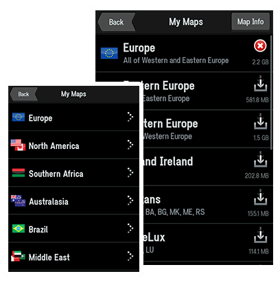
Before you can begin navigating, you MUST select and download maps for your CoPilot.
Important: We strongly recommend downloading your required map regions via Wi-Fi. Before you start, please make sure you have Wi-Fi switched on and are connected to a network with a good signal. You can also download maps via 3G/4G, although this may incur data charges from your mobile provider.
Note: You will only be able to download maps for a continent, region or country that you are licensed for. You will need to wait until your first map has finished downloading before you can begin navigating.
Your CoPilot lets you create and save multiple truck routing profiles that are specific to the physical attributes and load type of a vehicle to ensure safe, reliable truck-legal routing.
In the Main Menu, tap Route > Truck Routing Profile
You can select from a list of industry standard vehicle dimensions or use the 'Custom size restrictions' option to enter the Max Height, Max Width, Total Length and Total Weight of your Truck.
CoPilot routing can be further customized to take into account the transportation of hazardous materials. Select one or all from the following categories:
You can choose whether or not to display truck restrictions on the map.
Choose to Use, Avoid if Possible or Always Avoid toll roads along your route.
This feature allows for the favoring of certain road types and is further enhanced with the ability to select the maximum speed for each road type. CoPilot sends an audible warning should the speed selected be exceeded.
You can choose to Avoid or favor the following road types:
Choose whether or not to display truck warnings of known potential hazards on your route.
Designed for those occasions when CoPilot may be used for regular car-based navigation. This option allows restoration of neutral settings without losing current or other trucking profiles.
You can also choose to skip this step and go to the town or city centre, or select a cross street to navigate to an intersection.
With My Places you can navigate to frequently visited locations including your Home, Work, Favorites and Recent places.
Enter your home address and save it as one of your favourite locations so that you can enter it quickly every time you want to plan a journey to and from your home.
The easiest way to enter your home address is by choosing Address.
Your home address will be saved in your Favorites list.
Save your Work address to give you a quick and easy way to navigate to your work place.
You can save your work address in the same way as entering your Home address.
Your work address will be saved in your Favorites list.
You can create Favorites, so that you can return to your favourite restaurant, shop or place more easily, every time you want to go back there.
Create a Favorite
An info box will show the location on the map.
The destination will be saved in your Favorites list
Navigate to a Favorite
Once you've saved a destination as a favourite, it's easy to navigate there next time.
Here's how:
Manage your Favorites
You can edit a location saved in your Favorites list:
To delete a Favorite
The Today section of the Notification Center shows your Home, Work and most recent Favorite list.
To get started, pull down the notification Center and choose the Today tab. To include CoPilot in the Today section, tap Edit and select the
icon next to your CoPilot appTo navigate directly to your Favorites, simply pull down the notification Center and choose one of your Favorites from the list.
Your CoPilot app will open with your Favourite destination set.
Tap Go and start navigating.
*iOS 8 required on your iPhone/iPadCoPilot remembers all the places you have recently been to so that you can return to those places more easily, every time you want to go back.
Manage your Recent Places
To delete your recent places list, tap Clear All. You can save one of your recent destinations as a favourite location:
Whether you're running low on fuel, looking for a place to eat, or somewhere to stay, CoPilot can help you find it. You can search thousands of Points of Interest (POIs) like ATMs, restaurants, gas stations and car parks.
To set a POI as a destination, do the following:
In the Go To menu, select Points of Interest.
The most frequently used Points of Interest (POI) categories will be displayed:
To find additional types of POIs, tap More Categories or Search All
You can also search the POI database stored within your CoPilot, by simply typing in a keyword of the POI you require in the Search box.
You can search the Internet to find any product, service, brand, place, business, shop or anything you need.
You can also search Wikipedia article titles to find places of Interest
Tap Yelp to easily find local businesses and check out user reviews and ratings from the Yelp community. †‡
A list of nearby places will be displayed.
You can also search for POIs in a different location. Tap on Search Nearby at the top of the screen and choose from:
Select a POI from the list.
More information about the POI will be displayed. You can choose to:
You may also be able to dial the POI directly from a phone-enabled mobile device if a telephone number is displayed.
With CoPilot, you can navigate to one of the contacts saved in your address book.
Note: Your CoPilot may ask you to enter the city, street name and house number for a contact if the address saved in your address book is not correctly recognized.
Find any location on the map and tap it to enter it as a destination.
An info box will show the location on the map.
Use coordinates to enter a specific location as a destination to find your way to any place.
See the CommuteMe Settings
CoPilot makes it easy to find the best way to your destination.
Once you have entered a destination, CoPilot will calculate a route based on your current location (or starting point if you are using Plan or Edit Trip).
You can see the route that your CoPilot has created for your journey on a map, along with an itinerary* and info box about your destination. The roads for your route will be highlighted in green. Your current location or starting point is indicated with a green flag, your end destination is indicated with a red flag. The total distance and estimated journey time is shown at the bottom of the My Route screen.
TapIf you are happy with the route provided, tap GO to start navigating to your destination.
If you would like to change your planned journey, tap Edit to show your Plan or Edit Trip list.
You can access the My Route screen from the main menu by selecting Route > My Route.
In the My Route screen, tap Alternate to view up to 3 possible routes to your destination.
The different routes are color coded according to the roads used plus the distance and journey time for each.
Simply tap on the route you want to take and tap GO to be guided to your destination using that route.
With CoPilot you can drag a route to change it and create the exact route that you want.
While you're dragging, you'll see the route change with a green dashed line and Waypoints will be added along your route. Keep dragging until you're happy with the selection. CoPilot will automatically calculate a new route and update the distance and estimated journey time.
Now you can tap and drag to change the location of the destinations along your route.
As you drag, a green dashed line shows the previous position of your destination to its new one, together with the name of the road that you moved the destination flag to.
If you make a mistake or want to cancel the new destination, simply tap on the destination info box and select Delete.
Tap the Options button in the bottom left of the My Route screen to further customize your route and access trip preview features.
Change how CoPilot calculates your route based on the vehicle you're driving. See Vehicle Routing Profiles.
CoPilot works out the best route to your destination depending on whether you're driving or travelling by foot.
You can adjust how your CoPilot calculates routes based on the vehicle you're driving.
An icon is displayed in the dashboard to show you the mode of travel you've selected.
Once you've started your journey, you may need to make a detour to reach your destination.
You can also access this feature from the main menu, tap Route > Detour.
Your route may use a particular road that you would prefer to avoid.
There are two ways you can do this:
You can easily choose to avoid a road from the Directions guidance view.
A turn-by-turn list of all the roads on your journey will be displayed
You can return to your original route by selecting Detour then Cancel Detour.
The standard CoPilot driving view provides a 2D or 3D perspective of the road ahead. Details about the next turn are shown on the dashboard at the bottom of the screen, with a description of the turn, a large turn arrow and the distance to the turn.
Lane assist* arrows are displayed at the top of the screen when you approach a complex junction. Sign post* information is displayed at major intersections that match real-life signs.
*The availability of this feature may vary by country/regionThere's a choice of driving views available from the Driving Menu:
Here's how to switch between the single turn instruction and a list of directions:
Tap on the dashboard to view your next turn instruction in full screen view
Tap to see all roads, turn instructions and distances to each turn displayed in a list
2D Map & Directions – this split screen driving view combines the 2D map view with a list of turn instructions*.
3D Map and Directions – this split screen driving view combines the 3D map view with a list of directions*.
*This driving view is only available in iPad1. Zoom-out from the map | 9. Zoom-in on the map |
2. Real sign post display | 10. Speed limit display/alert |
3. Lane assist arrows | 11. Safety camera display/alert |
4. Current route | 12. Mode of travel |
5. My current position | 13. GPS status indicator |
6. Menu button | 14. Customizable info display – right |
7. Customizable info display - left | 15. Next turn distance and direction |
8. Next approaching turn |
To zoom in and out of the map either pinch the map with two fingers or tap the
and buttons at the top of the map display.You can move around the map by dragging up, down, left, or right.
Two additional information displays are shown on the lower left and right hand side of the dashboard, providing useful information such as estimated time of arrival and distance to destination. You can tap on either of these to choose what information you would like shown, including:
Shows useful location information about your journey on the map including: Current Road, Destination, Nearest Town or the place where you're Heading towards.
A small turn indicator is displayed above the large Next Turn indicator for situations when you need to make two turns in quick succession.
If you drag the map away from your current location or route, the My Current Location button will appear on the top left of the screen. Tap to snap the map back to your current location.
Note: This feature requires a GPS fixCoPilot can display the speed limit of the current road and warn you if you accidentally exceed it. You can adjust this feature in the Settings menu.
CoPilot can warn you on the approach to a safety camera* location, showing you the distance to the camera and the speed limit of the road. You can adjust this feature in the Settings menu.
CoPilot can alert you about specific types of POIs on your route. Simply tap the POI alert to bring up more information about the place and then choose to Ignore or Go to the POI. You can adjust this feature in the Settings menu.
See the Driving Menu
CoPilot is designed to help you find your way around on foot, making it easy to see exactly where you are and where you need to get to.
In walking mode, your location is displayed as a dot on-screen rather than a direction arrow. Once you have entered a destination, CoPilot will draw a dashed line there – just follow the line.
CoPilot also provides turn by turn directions along streets and footpaths where available in the map.
See the Walking Menu
You can tap on any town or city, road or Point of Interest, or any flag – Destination, Waypoint, or Start Location to find out more information about it, add it as a destination or view additional location specific information.
You can also see more information about the destinations you've entered, manage them and change your trip.
Here's how:
An info box will show the location on the map.
Select Settings to adjust how CoPilot shares your location information on Facebook and Twitter.
CoPilot will open your device’s email application so that you can select people to email and customize the message.
Your CoPilot lets you plan a journey from start to finish with as many destinations and waypoints as you like.
Important: For safety reasons, always plan your journey before you start driving and ensure that your device is securely mounted.
CoPilot lets you plan a journey with multiple destinations. Here’s how:
If you're planning a journey with multiple destinations, you can change the order you want to visit each location.
A pop-up menu will display a list of options.
You can also tap and hold a stop in your trip list then drag and drop it to a new position to change the position of where it appears in the list.
CoPilot can save your current location as a destination so that you can find your way back there later.
Your current location will be saved in your Recent places list.
Note: You will only be able to save your location if you have a valid GPS fix.
You can view any of the destinations you're planning on going to on a map:
To return to the Plan or Edit trip list, tap Back.
CoPilot can route you through a specific place without considering it as a stop. By setting Waypoints you can adjust CoPilot's route, to calculate a detour via the waypoint.
A pop-up menu will display a list of options.
A message advising You are close to your waypoint will be displayed in the dashboard when you approach the waypoint along your route.
To change a Waypoint back to a Stop, select the destination and choose Set as Stop from the pop-up menu.
You can save destinations listed in your Plan Trip list as Favorites, so that you can easily return to those places.
A pop-up menu will display a list of options.
The address will be saved in your Favorites list.
Once you've entered a destination, you can always delete it from your itinerary if you no longer wish to go there.
A pop-up menu will appear containing a list of options.
In the Plan or Edit Trip screen, tap Calculate Route to work out the best route for your planned journey.
Load & save trips, optimise your route and more with the Trip Options menu
Your CoPilot has additional trip planning functions that can help you plan your journey more effectively. From optimizing your route to checking on the fuel costs for your journey, your CoPilot can help.
In the Plan or Edit Trip screen, tap Trip Options.
The following options are available:
You can delete all the destinations in your Plan Trip list.
If you've already saved a trip, you can re-load it easily anytime you want to make it.
To remove the saved trip, tap Delete.
For any trips that you make regularly, it’s worth saving those trips so that you can access them any time you need to make the same trip.
If your trip contains 3 or more stops, you can use CoPilot's powerful trip optimizer to calculate the best way around multiple destinations. Simply enter all of the places you want to visit for your journey and let CoPilot re-order them into the most efficient route.
You can calculate the estimated fuel costs for a trip.
You can clear your current destination and stop receiving turn by turn guidance.
This will clear all destinations and waypoints from your trip. You can return to the map view to monitor your current location by selecting the Map button in the top left of the screen
CoPilot makes it easy for you to check the weather† conditions and forecast at your current location, destination, or any city.
You can also find out what the current weather conditions are like and get a 5 day weather forecast, at the touch of a button.
From the main menu, tap More > Weather.
Temperature Metrics
You can choose to show the temperature in degrees Celsius (°C) or Fahrenheit (°F).
On your journey, if something unexpected happens to your vehicle, CoPilot can put you in touch with a roadside assistance company quickly.
You will see:
Your CoPilot can search Wikipedia†‡ article titles to help you find places of Interest.
A list of nearby Wikipedia places will be shown.
This will bring up the Wikipedia article for the place you selected.
You can also...
If you'd like to display all the Wikipedia places on a map, instead of showing them in a list, tap Map. To show them in a list again, tap List.
You can use real-time traffic flow information to calculate the fastest route around traffic jams and view an accurate ETA to your destination.
ActiveTraffic*† uses high-quality traffic flow information, including real-time traffic speeds and location reports, to maintain a realistic ETA based on actual road conditions.
The ActiveTraffic service automatically monitors your route for delays as you drive and can alert you if a quicker alternate route is available, along with a preview of the route and the amount of time you'll save.
From the Main Menu, tap Settings > ActiveTraffic and check the box next to Enable Traffic
You can choose how far ahead, on your route, you would like to see traffic information.
You can also choose how often you would like traffic information to be updated.
Finally, choose when you would like to be alerted of a traffic delay along your route. You can choose to be altered if a traffic delay is more than 10 mins, 15 mins or 20 mins.
ActiveTraffic can provide an at-a-glance display of traffic conditions so you're constantly informed of traffic conditions along your route and in the surrounding area. It can also show detailed information for traffic incidents along your route.
When ActiveTraffic is enabled, CoPilot will automatically change the color of your route line to display traffic congestion along your route, as you drive. Sections of the route with moderate congestion will appear yellow and severe congestion will appear red.
CoPilot can display a traffic bar alongside the map showing a color-coded view of real-time traffic conditions along your route. Sections of the route where traffic is moving freely are green, those with moderate congestion yellow and severe congestion red.
The latest traffic information will be continually updated as you drive.
CoPilot can display a map showing traffic conditions and incidents along your route. On the map, sections of the route where traffic is moving freely are green, those with moderate congestion yellow and severe congestion red. Traffic incidents along your route will also be displayed. Tap on the incident for more information about the incident including the type of incident e.g. construction, location of incident, average speed at incident plus a description to help keep you better informed of what's ahead.
To bring up the traffic map:
Or
Here you can also...
When ActiveTraffic is enabled, CoPilot is constantly monitoring traffic conditions while you drive to ensure you are taking the fastest route to your destination. If a faster route is identified, CoPilot will alert you with an alternate route along with the estimated remaining travel time to your destination.
To manually check for a faster alternate route:
If a faster route is available CoPilot will display an alternate route along with the estimated remaining travel time to your destination.
Need fuel? CoPilot gives you the most up-to-date information about fuel prices*†‡ to help you decide the best place to fill up.
From the main menu, tap More > Fuel Prices.
A list of fuel stations will be shown.
The fuel station is displayed on a map plus information about the location and the price of the different types of fuels available.
You can also...
To search for more fuel stations, tap More Results
If you'd like to display all the fuel stations on a map, instead of showing them in a list, tap Show Map. To show them in a list again, tap Show List.
To adjust your fuel price settings, tap Fuel Settings.
You can decide on how the fuel price search results are shown in the list.
Choose from the following two options:
To show fuel stations in order of nearest to furthest, tap Sort by distance
To arrange fuel prices from cheapest to the most expensive, tap Sort by Price.
You can also:
Choose to show Any Grade or pick the fuel grade that's right for your vehicle's engine.
To change the Search Radius that CoPilot searches within choose from the following options: 100, 50, 25, 10, 5 or 1 mile/kilometre radius
As you approach your destination, CoPilot will display the Now Arriving popup.
You can choose from the following options:
You can let people in your social network know you've arrived at your destination, using Facebook, Twitter or Email†.
Post preview shows you the standard message that will be posted.
Select Settings to adjust how CoPilot shares your location information on Facebook and Twitter.
CoPilot will open your device's email application so that you can select people to email and customize the message.
Save the destination as one of your Favorite locations
Save the location of your car‡
Clears your current destination
Quit the CoPilot app*
Once you've parked your car, you can save your location so that you can easily find your way back to it later.
Tap Edit Notes, type your note and then tap Save. You can see your note at the bottom of the screen.
To edit or delete your note later on, just tap Edit Notes again.
You can review all the standard features in your CoPilot, together with all the great extra features, services and subscriptions also available.
Here, you can purchase extra content for your CoPilot from within the app.
You'll be required to create or enter your MyCoPilot ID to continue with the purchase.
Restore - lets you re-download any feature(s) you have already purchased from with the app again for free
Let's you manage your CoPilot maps.
Here you can choose from the following options:
You can create a CoPilot ID or sign in with your existing CoPilot ID.
If you’re already signed in with your CoPilot ID you can view and also change the email address or password for your CoPilot ID.
If you have forgotten the password for your CoPilot ID, please enter the email address you used to create your account to receive a reminder.
You can easily restore your feature upgrades and subscriptions in the event of a problem.
CoPilot regularly releases software and map updates† that you can download directly to your mobile device.
We recommend you regularly check for new updates for your CoPilot.
To get the latest updates:
A list of available updates will be displayed.
If you've got a question about your CoPilot, chances are we've got the answer already covered in our FAQs.
Select a FAQ topic, to find easy to understand and complete answers to any important questions you might have about CoPilot products and services.
Join the CoPilot Community Forum to connect with us and other CoPilot users around the world. You can ask a question, share an idea, report a problem, and tell us what you love about your CoPilot plus lots more.
If you have a question about CoPilot, ask us and we'll give you the answer.
You can write a review, and choose a star rating, for your CoPilot navigation app on the App Store to let others know what you think.
Enjoying your CoPilot? Then recommend us to your family, friends and colleagues†.
Introducing your friends to CoPilot is simple. Simply enter their email address to send them a message about CoPilot.
They will wish you had told them sooner.
Keep your maps up-to-date and accurate with our ALK MapSure™ service, including quarterly and monthly map updates.
You can backup your Favorites, Recents and Subscriptions over the Cloud with your CoPilot ID. If something ever happens to your CoPilot app, you can easily restore your data from backup to a new or existing device.
Cloud backup
Let's you save all your Favorite and Recent settings and subscriptions securely online in the Cloud.
You'll first need to sign in with your CoPilot ID
Tip: It's good practice to periodically back up your account settings to safeguard your data, in case something happens to your CoPilot or device.
To restore your settings and subscriptions from Cloud backup, do the following:
Let's you change the look and feel of the maps included with your CoPilot. You can also decide whether certain features like Points of Interest are shown in the map.
Tap Settings > Map Display
The following options are available:
Choose from a variety of map color schemes and styles for the day and night.
You can set your CoPilot to use a Day Only or Night Only map style, or choose Auto to switch between the day and night map styles you have selected.
Your CoPilot will automatically switch between day and night mode based on
CoPilot can show useful location information about your journey within a customizable information box displayed on the map.
You can choose whether you want CoPilot to show you the Current Road, Destination, Nearest Town or place where you're Heading towards.
To set when to display POIs on the map.
Choose to show POIs Always, When Stopped or Never.
You can select which specific POI categories are shown on the map, by selecting Currently Displayed POIs.
You can set CoPilot to alert you about specific types of POIs on your route.
To receive on-screen and spoken POI alerts, select the Show POI Alerts tick box.
To set how close to a POI you want to be alerted, tap POI Alert Distance and pick a distance from the list.
Choose to show POIs that are On Route or Near Route.
You can select which specific POI categories you want to receive alerts for. Tap Select POIs to alert then pick a POI category, multiple categories or Select All.
To show a map view on approach to a turn while in the Directions view, tap Show Map in Directions View.
Here you can set how near to a turn you'd like to be before your CoPilot switches from the directions view to a map view
Lets you adjust the 2D map display. Choose from the following options:
2D Map Rotation
CoPilot can display a turn restriction sign in the map view to show you where any restricted turnings are along your route.
You can choose exactly how you'd like to be guided for every journey you make.
Tap Settings > Guidance
At some intersections and exits, CoPilot can display a more realistic image of the road layout with lane indicator arrows and real sign post information.
To switch ClearTurn on and off, tap the Show ClearTurn checkbox.
Turn Warning Distances
Lets you choose how far from a turn you wish to be before you receive a spoken next turn instruction.
Background Navigation
Your CoPilot can continue to provide you with turn-by-turn voice directions while you're on a call or using another app on your mobile device.
You can select the following options:
Let's you choose how near to a turn CoPilot provides the spoken 'Turn Now' instruction.
CoPilot can display a second turn arrow when you need to make two turns in quick succession.
If you enable this feature, CoPilot will learn your preferred daily commute and then use it every time you commute between home and work with real-time traffic* and ETA information along the way. If you disable this setting, CoPilot will calculate a route based on your Vehicle Preferences.
You can choose which days of the week you would like to use CommuteMe™ to help guide you between home and work.
You can also set which time of day you would like to use CommuteMe™ to guide you along your preferred route.
The ActiveTraffic service uses real-time traffic conditions information to intelligently calculate the fastest route to your destination, provide an accurate ETA based on traffic and automatically avoid delays.
Tap Settings > ActiveTraffic.
If you enable this service, CoPilot will check for traffic along your route. If you disable this setting, CoPilot will not monitor and alert you for traffic delays.
You can choose how far ahead, on your route, you would like to see traffic information.
Choose how often you would like CoPilot to update the traffic information it receives at the time interval chosen here.
You can choose when you would like to be alerted of a traffic delay along your route. Choose from 10 mins, 15 mins or 20 mins.
Safety Cameras* warn you when you are approaching a safety camera location.
CoPilot displays the location of the safety camera on a map and gives you a spoken warning.
You can change the way your CoPilot warns you about safety cameras, tap Settings > Safety Cameras.
You can set how close to a safety camera location you want to be warned.
We recommend you regularly update the safety camera database so that you have the latest locations for alerts when you're travelling. Update the Safety Camera database from the News & Updates screen
CoPilot can display the speed limit* of the road you are on and can warn you to slow down if your speed exceeds the maximum speed limit of the road.
To set the way your CoPilot warns you about speeds limits, tap Settings > Speed Limit.
If you drive faster than the speed limit, your speed is shown in red.
To set CoPilot to warn you if your speed exceeds the limit:
To hear a warning sound if you're speed exceeds the limit, select Receive audible speed warning.
CoPilot provides on-screen and voice guidance in a wide range of languages.
You can change the language used by your CoPilot.
Once you have selected a language, you can then choose the voice you want to use.
Select a voice from the list.
You can:
Your CoPilot has two different kinds of voices:
TTS voices are indicated with an asterisk.
You can change the entire color scheme of your CoPilot app with our themes collection.
Get more color schemes
To explore and download more background color themes for your CoPilot, do the following:
To change the theme at anytime, tap Settings > Themes and select a different theme from the list.
You can share your journeys with people in your social network using Twitter and Facebook†.
Select Settings > Sharing Setup
Tap Connect to login to your Facebook account using CoPilot. Your device will open an external screen to login to Facebook and then return to CoPilot.
Tap Sign In to login to your Twitter account through CoPilot. Enter your Twitter username and password and select if you would like to Enable Geotagging.
CoPilot can automatically post updates about your location on your wall. To do this, select from the following options:
Tap Sign Out on either the Facebook or Twitter buttons to stop sending posts.
CoPilot relies on GPS satellite signals to locate you on the map and to provide turn-by-turn guidance to your destination. To check the current status of your device's GPS reception, select Settings > GPS.
The GPS Status screen displays the information received from your device's GPS receiver. You can see your current latitude and longitude position, the
Your CoPilot will automatically use your device's built in GPS receiver for navigation
It's important that the location, date and time are set correctly on your device to ensure that the GPS information you receive is accurate. The first time you use a GPS receiver it may take a few minutes to determine your current position. In future, your position will be found much faster.
To ensure you have the best possible GPS reception, make sure that your device has a clear line of sight to the sky. Large objects, like big trees and tall building, can sometimes interfere with your device's GPS signal.
CoPilot can use enhanced positioning technology to provide continued guidance when you're driving in a tunnel. The In tunnel mode icon will be displayed.
You will not be able to get a GPS signal inside buildings, garages, multi-storey and basement parking lots.
CoPilot makes the following kinds of sounds:
To adjust the sounds played by your CoPilot, tap Settings > Sound.
You can adjust the volume level of your CoPilot using the volume buttons on your device.
Choose Mute All Sounds, to turn off all CoPilot sounds. When set to mute, CoPilot doesn't provide any spoken instructions, alerts or button sounds.
Choose Turn on Button Click Sounds to if you would like to hear a click sounds every time you touch a button in CoPilot.
You can change how CoPilot plays spoken instructions when you're also listening to music on your mobile device. Choose from the following four options:
You can adjust the way your CoPilot lets you interact with the map while on the move.
Tap Settings > Motion Lock.
To switch Motion Lock on and off, tap the Enable Motion Lock checkbox.
If you enable this feature, CoPilot will disable your ability to tap or pan around the map while travelling above a specified speed. If you disable this setting, you can interact with the map display fully at any speed.
When Motion lock is enabled the button will be displayed on the top left of the map screen
A front passenger can disable motion lock by tapping on the button to start interacting with the map. When asked if you would like to Enable passenger mode and unlock the screen? Select Yes.
Lets you set the minimum speed you’re travelling at before the map becomes locked for safe, hands free driving. Choose from 5, 10, 15 and 20 mph.
You can set your CoPilot to conserve power to help you get the most use out of your device's battery life.
CoPilot can save power consumption by reducing the amount of times it updates the map on the screen, per second.
In the Main Menu, tap Settings > Power Saving.
The following options are available: